Christmas is just another day for me.
I’m not religious, and if forced to choose I would pick the old Greek and Roman pagan gods over any current creed or belief system.
We don’t have any family in Malta either. And so, rather than sit around at home working, we decided to take advantage of the silence of the countryside to do a little exploring. It was a nice sunny December day, and the guns of the hunters in a nearby field had fallen silent. This was a rare opportunity to go walking during a season when every inch of the countryside normally sounds like a war zone.
Since December 25th also marked the Roman festival of Dies Natalis Solis Invicti (Birthday of the Unconquered Sun), I thought it would be fitting to go looking for Roman and Punic remains in a rather isolated spot not far from my town.
We laced up our boots, hopped in the car, and set out for Bahrija, a small rural village whose name means “moth” in Maltese.
We passed through the village, drove down into the valley and left the car on a steep slope next to the ruins of a farmhouse. A path led off from here through some tall rushes, and I could see it winding up the hill in the distance. This was promising…
We climbed for a few minutes through an area of thick vegetation — a rare sight on an island as rocky and sun baked as this one. But before long, every option was barred with gates and fences and “Keep out” signs.
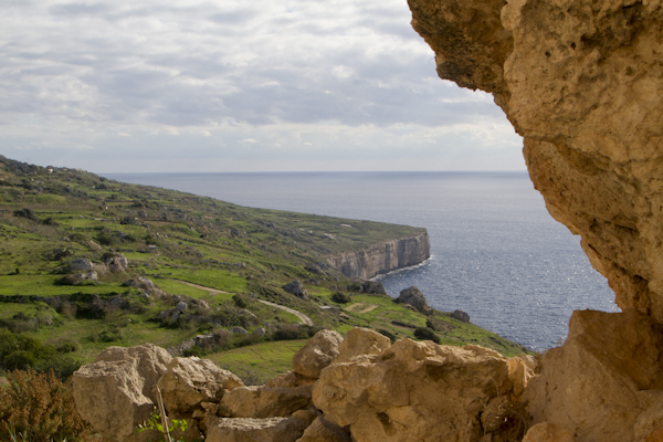
We were able to get a view of the coast, but we couldn’t reach my objective in this area: IL-Qliegha Tal-Bahrija, an isolated plateau surrounded by cliffs. This commanding position, high atop a cap of Upper Coralline limestone, was the site of a Bronze Age settlement. The area is littered with pottery sherds from the second and third Bronze Age phases, and bell shaped cavities (possible grain storage or water cisterns) are cut into the rock.
Unfortunately, we couldn’t see any of these things. After a lot of swearing, we trudged reluctantly back down to the car and went in search of the day’s other main objective: the isolated promontory of Ras Ir-Raheb.
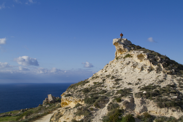
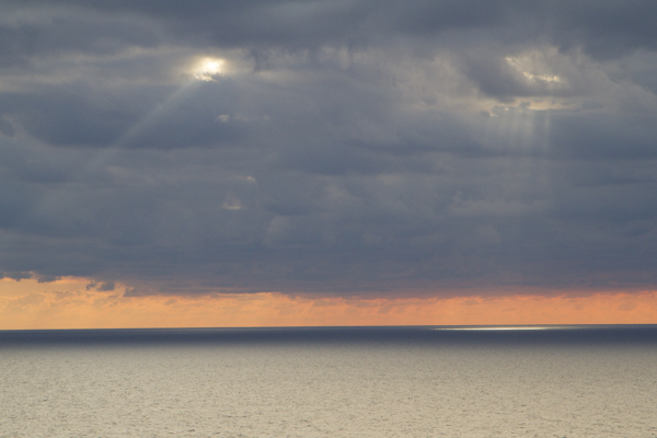
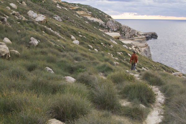
This flat point surrounded by sheer cliffs has been a sacred sight since ancient times. And it has what might just be the most incredible views in all of Malta.
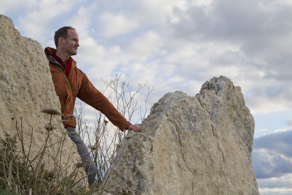
The ruins lie partially buried at the far end of the point, beyond the “keep out” signs and ratty hunter’s shacks, with a commanding view of the sea. I spotted them from a distance thanks to two upright megaliths, and I picked my careful way over small plants and clumps of grass littered with rusting shotgun shells.
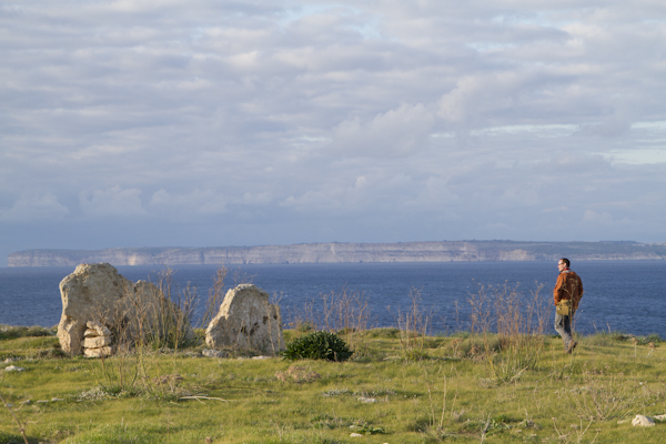
The megaliths had been incorporated into a later site, and the foundations of a building begin on the seaward side, mostly covered in grass. A courtyard is clearly visible, surrounded by a wide corridor with a room branching off. There’s a rock cut cistern too, and I could see the shine of water far below in the darkness.
No one’s quite certain what this site was, but some incredible artifacts were unearthed here, including: an ivory plaque with a crouching boar that has been traced to 5th century Etruria; a pair of clay satyr masks; and a male figure with a lion skin tied around his waist, most likely representing Hercules.
Coins were also found on the site from the Sicilian Punic period, as well as a late Roman coin depicting Constantine II (337-361 AD).
Of all the theories proposed for this place, I think the most likely — or at least, the one I’d like to believe — is that it was a sanctuary of Hercules.
Such a site would be visible far out to sea, and would thus be an important landmark for ancient mariners crossing between North Africa and Sicily.
It’s an incredible setting to wander around, with views of the island of Gozo in the far distance, and a vast empty sea that stretches all the way to Libya rolling gently at your feet.
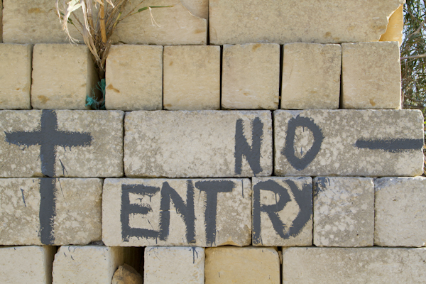
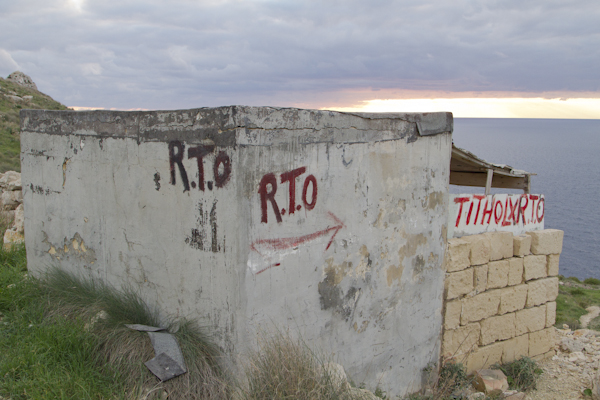
But unfortunately this site of great historical importance isn’t very easy to access. Part of the path out here crosses the private land of a local farmer, and aggressive hunters have taken over the rest. Their filthy little stone bunkers dominate the view when you look back landward, and the entire scene bristles with aggressive “Keep out” signs and red painted “RTO” warnings.
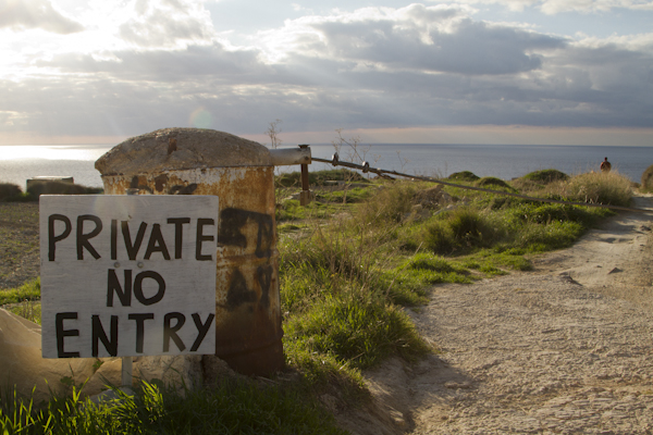
These people don’t actually own the land; they’ve taken it over, just as they’ve done to so much of the island’s remaining countryside. And they wave their guns and yell at anyone who dares go there for a walk. The only reason we didn’t encounter groups of these guys is because we went on Christmas Day. The guns were silent; everyone must have been at a hotel buffet.
This blight on the landscape isn’t the only mark left by the hunters. It was only after we’d been wandering the site for 15 or 20 minutes that I realized we hadn’t seen any wildlife at all, apart from one black beetle. When the wind died down, it was replaced by total silence. There wasn’t any birdsong because the hunters have killed them all. They aren’t shooting for the table, but simply because they like to blast away at anything that flies — including endangered species.
Unfortunately, the hunters are in a minority but they have a powerful political lobby. Nothing is likely to change.
This isolated place is actually just above a spot called Blata tal-Melh that I explored the previous year [see photos here]. I wanted to climb back down there to photograph the salt pans, but it was already growing dark.
And so we reluctantly headed for home to put up our feet, pull the cork on a bottle of wine, and raise a glass to the Roman empire for leaving us so many interesting ruins to explore.
Photos ©Tomoko Goto 2014
Get your FREE Guide to Creating Unique Travel Experiences today! And get out there and live your dreams...